Trail Other activity Le Lieu - Vallée de Joux - Sentier des Gendarmes - Photo

Vallée de Joux - Sentier des Gendarmes

 Romrando
Romrando

User

© OpenStreetMap contributors
Length
Length
19.9 km
Max alt
Max alt
1400 m
Uphill gradient
Uphill gradient
552 m
Km-Effort
Km-Effort  
27 km
Min alt
Min alt
1012 m
Downhill gradient
Downhill gradient
563 m
Boucle
Boucle
No
Creation date :
2014-12-11 00:00:00.0
Updated on :
2014-12-11 00:00:00.0

(0 Reviews)

Other activity
Other activity
--
Difficulty : Unknown

Scan this QR Code to open this trail in the SityTrail application

FREE GPS app for hiking

Logo SityTrail SityTrail

IGN / Geographical institutes

Download SityTrail from the App Store Download SityTrail from Google Play

Logo SityTrail SityTrail World

The world is yours!

Download SityTrail from the App Store Download SityTrail from Google Play Download SityTrail on Huawei AppGallery

About

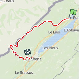
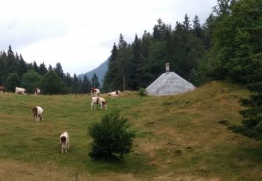
Trail Other activity of 19.9 km to be discovered at Vaud, District du Jura-Nord vaudois, Le Lieu. This trail is proposed by Romrando.

Description

Source:geocities.com/romrando

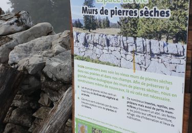
Magnifique parcours forestiers.

Des Charbonnières vers l''W gagner une petite combe et la suivre direction SW, traverser la route puis rejoindre le "Haut Crêt".

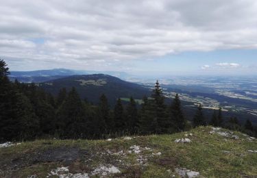
Monter sur "La Frasse". Vers le N sur Le Chalet Neuf puis rejoindre "Les Plainoz". Vers le SW on atteint la "Grande Tèpe". Suivre encore 500 m à plat puis par un petit sentier forestier monter jusqu''aux "Fougères".

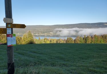
Suivre alors le Sentier des Gendarmes qui suit la ligne de crête, passe par "Les Mines" puis rejoint la "Grande Landoz" dans une vaste clairière. De là on descend sur Le Sentier par la petite route nommée "Chemin des Auberts". (Retour par le train)

Elevation profile

Positioning

Country:
Switzerland
Region :
Vaud
Department/Province :
District du Jura-Nord vaudois
Municipality :
Le Lieu
Location:
Unknown
Start:(UTM)
294456 ; 5171548 (32T) N.

Trails nearby

Trail On foot Vallorbe - Mont d'Orzeires - Le Pont Gare - Photo
On foot
PRO

On foot

Easy
Vallorbe, Vaud, District du Jura-Nord vaudois, Switzerland
3.2 km | 4.4 km-effort
59min
No
Trail On foot L'Abbaye - Pétra Félix-Dent du Vaulion - Photo
On foot
PRO

On foot

Easy
L'Abbaye, Vaud, District du Jura-Nord vaudois, Switzerland
3.1 km | 6.3 km-effort
1h 25min
No
Trail On foot Vallorbe - Saigne Geret-Les Revines - Photo
On foot
PRO

On foot

Easy
Vallorbe, Vaud, District du Jura-Nord vaudois, Switzerland
3.5 km | 4.1 km-effort
56min
No
Trail Walking L'Abbaye - La Dent de Vaulion - Photo
Walking
drarep

Walking

Very difficult
(1)
L'Abbaye, Vaud, District du Jura-Nord vaudois, Switzerland
14.6 km | 22 km-effort
4h 31min
Yes
Trail Snowshoes L'Abbaye - Le Pont dent de Vaulion Suisse - Photo
Snowshoes
janussity

Snowshoes

Very easy
L'Abbaye, Vaud, District du Jura-Nord vaudois, Switzerland
16.1 km | 24 km-effort
4h 20min
Yes
Trail Walking Mont-la-Ville - Col du Mollendruz- Châtel12.08.16 - Photo
Walking
duamerg

Walking

Easy
Mont-la-Ville, Vaud, District de Morges, Switzerland
12.6 km | 18.5 km-effort
4h 4min
Yes
Trail Walking L'Abbaye - Suisse Le Mont tendre - Photo
Walking
ericf64

Walking

Medium
L'Abbaye, Vaud, District du Jura-Nord vaudois, Switzerland
15 km | 24 km-effort
5h 2min
Yes
Trail Walking Mont-la-Ville - Jura Club Grand Tour belle vue lac leman - Photo
Walking
PC CP

Walking

Easy
Mont-la-Ville, Vaud, District de Morges, Switzerland
3.4 km | 4.8 km-effort
1h 6min
Yes
Trail Walking Vallorbe - Vallorbe La Dent du Vaulion Fort du Pré Giroud 4 août 2020 CAF - Photo
Walking
TRIMAILLE

Walking

Difficult
Vallorbe, Vaud, District du Jura-Nord vaudois, Switzerland
19.7 km | 32 km-effort
7h 1min
Yes


Close
My subscriptions